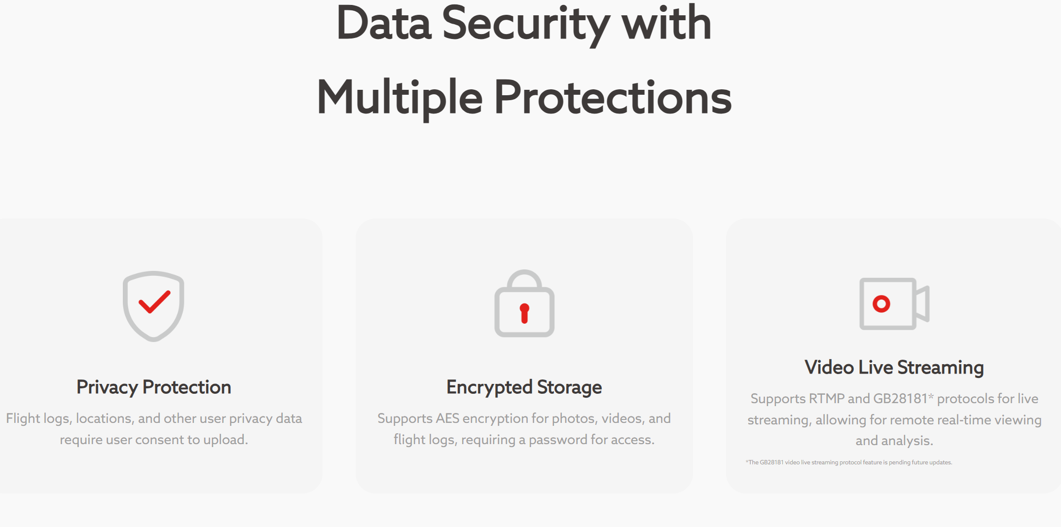
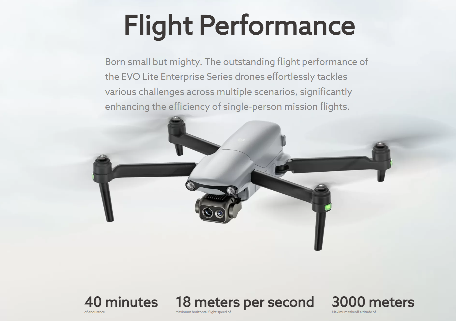
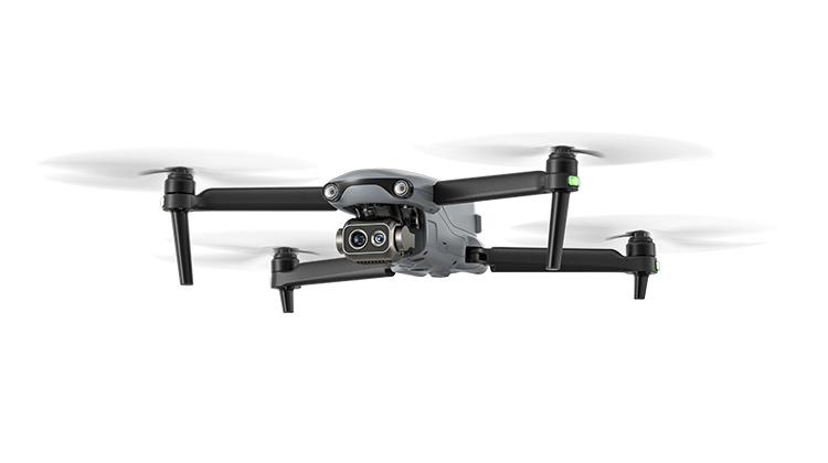
EVO Lite Enterprise Series

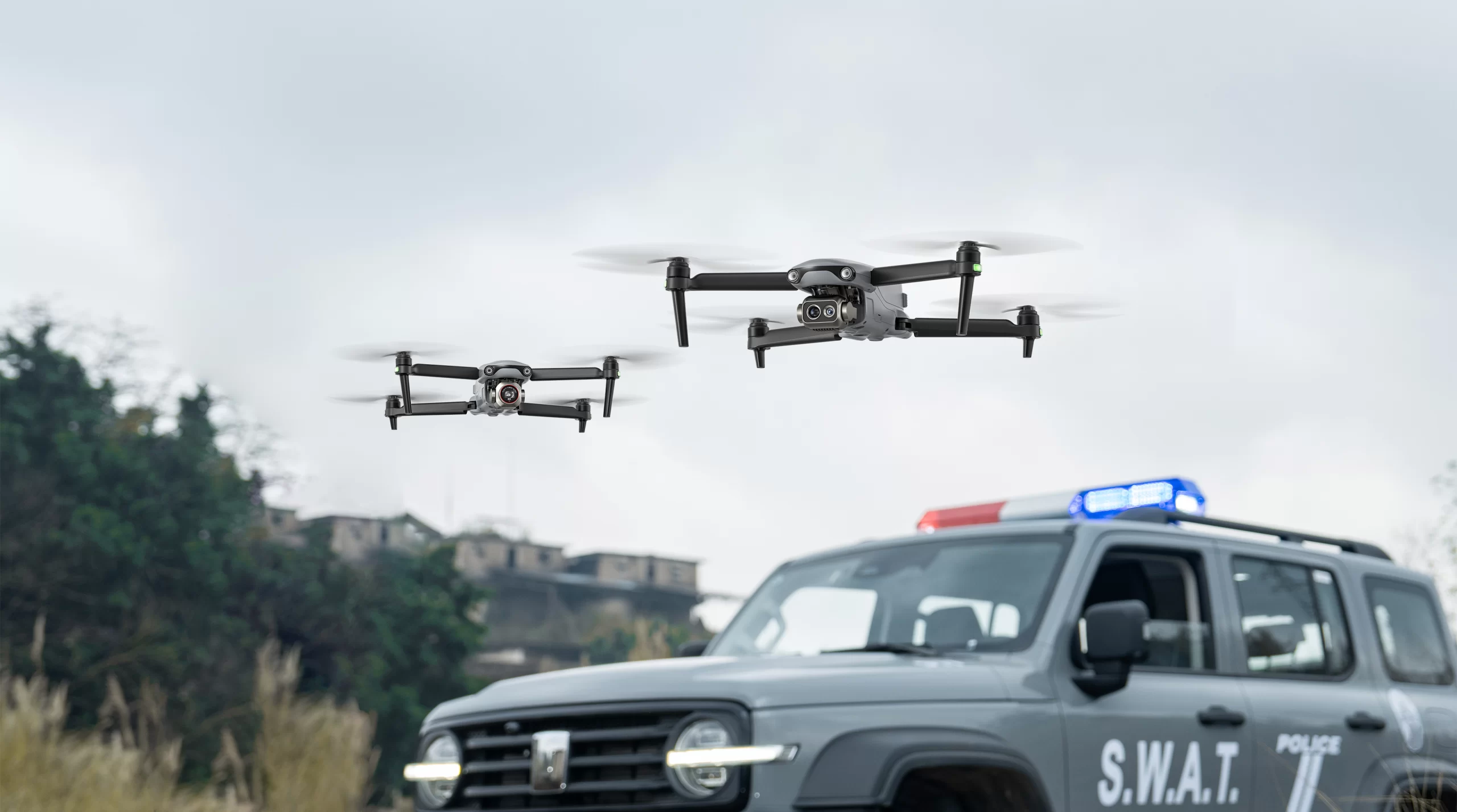
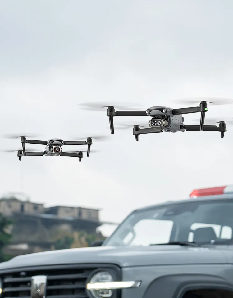


Lightweight Yet Mighty
Video

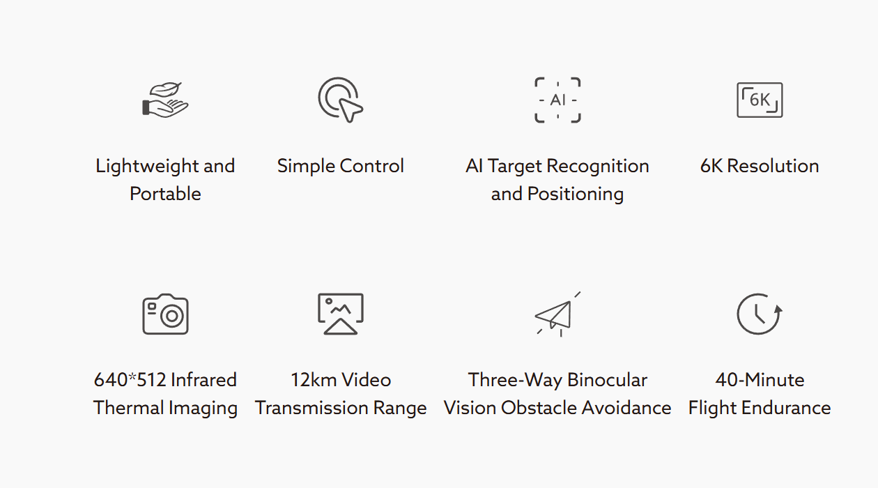
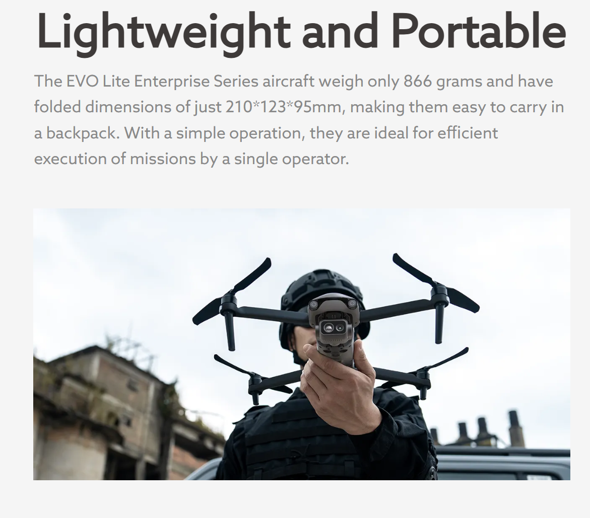
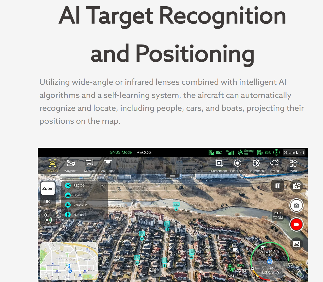
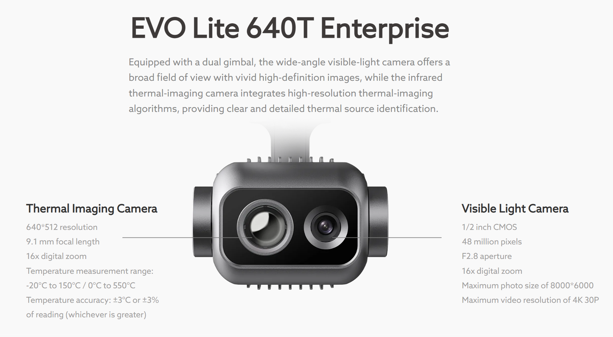
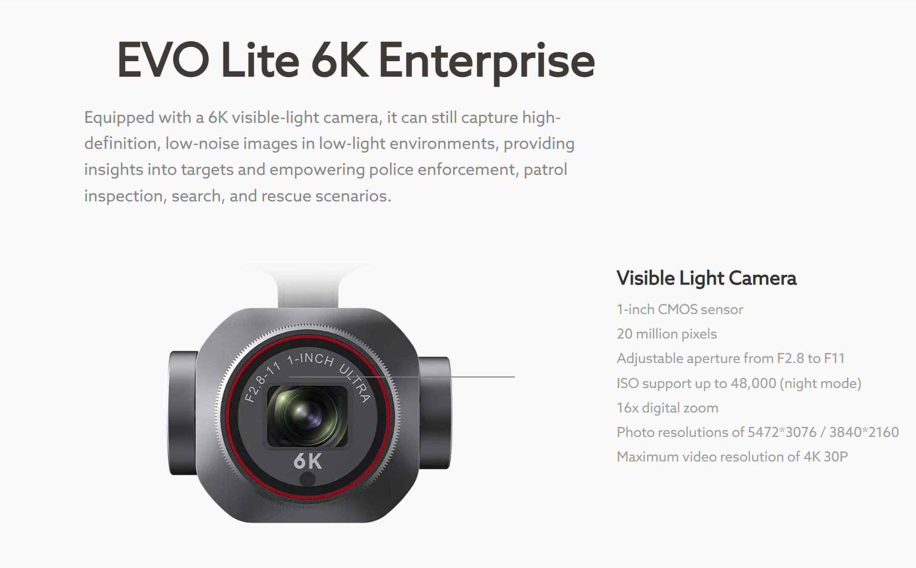
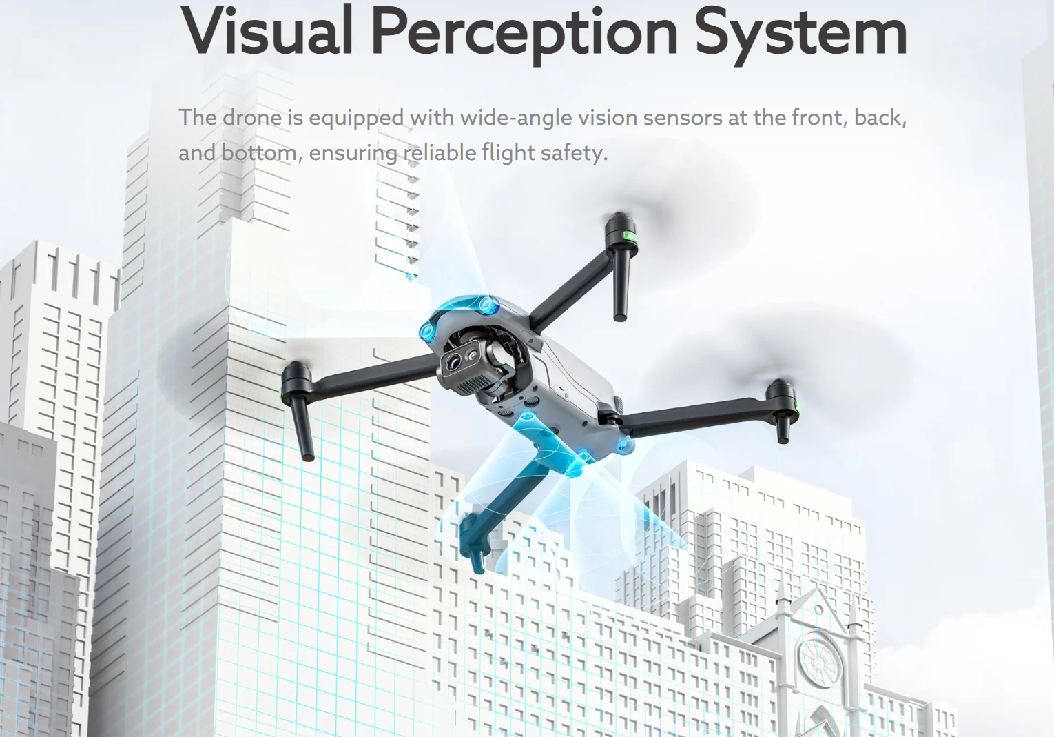
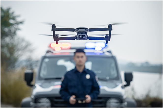
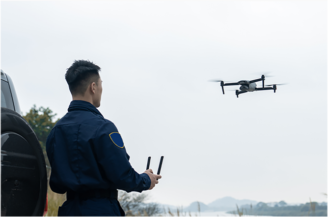
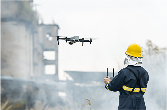
The EVO Lite Enterprise Series, by Voltaris Robotics, offers multiple advantages such as a lightweight and portable design, rapid deployment, and simple control for industrial applications. The AI target recognition feature enables the aircraft to easily identify and map various target objects automatically. The three-way binocular vision obstacle avoidance provides a safe flying experience. The EVO Lite 640T Enterprise features a dual gimbal system, with a visible-light camera providing clear and detailed images, while the thermal-imaging camera aids in decision-making during operations. The EVO Lite 6K Enterprise is equipped with a 1-inch CMOS visible-light camera, offering outstanding sensitivity for excellent image quality. Paired with the Voltaris Enterprise professional flight software, it offers easy operation, user-friendly interaction, flexible single-person deployment, and efficient application in scenarios such as public safety and emergency rescue.
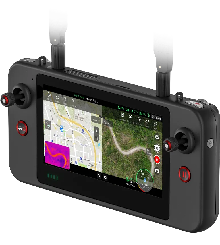
Voltaris Enterprise App
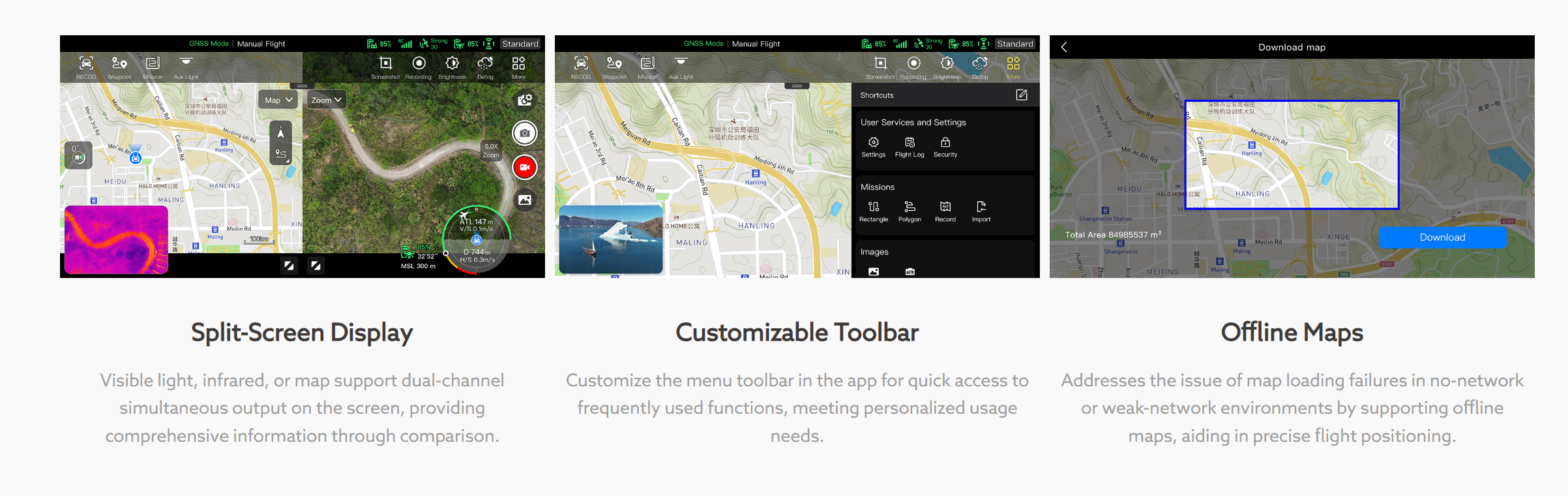
Voltaris Enterprise is a professional flight mission software designed for industry applications by Voltaris Robotics. It features an optimized interaction design for simple and efficient operation, an editable toolbar design for intuitive use, and integrates intelligent and professional functions to fully utilize the industry value of the EVO Lite Enterprise Series aircraft.
EVO Lite Enterprise Series
Technical Specifications
-
Aircraft
Weight 866 g Maximum takeoff weight 866 g Dimensions
210×123×95mm (folded, propellers included)
433×516×95mm (unfolded, propellers included)Max. rotation speed 8000 rpm Wheelbase 368 mm Propeller Dimension 8.5 inch injection molded propeller. Spec: 8530 Propeller weight 7.5 g Maximum ascent speed
Slow:3 m/s
Smooth:3 m/s
Standard: 5 m/s
Ludicrous: 6 m/s
Maximum descent speed
Slow:3 m/s
Smooth:2 m/s
Standard: 3 m/s
Ludicrous: 4 m/s
Maximum horizontal flight speed
(no wind near sea level)Slow :3 m/s
Smooth:5 m/s
Standard: 10 m/s
Ludicrous: 18 m/s
Maximum Service Ceiling Above Sea Level
3000 meters
Maximum flight altitude
Chinese Mainland or EU: no more than 120 meters
US: no more than 400 feet
Note:
In the flight application UAV, it can be set from 0 to 800 meters. To set beyond height required by law, you need to obtain authorization from authority.
Maximum flight time
(no wind)40 minutes
Note: Tested in lab with nearly no wind when aircraft flies at speed of 10 m/s and only for reference.Maximum flight mileage
24 km
Maximum hover time
(no wind)
37 minutes
Note: Tested in lab with nearly no wind when aircraft hovers and only for reference.Maximum Wind Speed Resistance
10.7m/s
Maximum tilt angle
Slow: 15°
Smooth: 30°
Standard: 30°
Ludicrous: 33°
Maximum rotation angular speed
Smooth: 60°/s
Standard: 120°/s
Ludicrous: 200°/s
Working temperature
-10℃~40℃
Battery hot replacement
Not support
Internal storage
Onboard storage: 4GB (support microSD card of up to 256GB)
GNSS
GPS/BDS/GLONASS Hover accuracy
Vertically:
±0.1 meters (when visual positioning is working normally)
±0.3 meters (when GNSS is working normally)
Horizontally:
±0.15 meters (when visual positioning is working normally)
±0.3 meters (when GNSS is working normally)
-
Image Transmission
Operating Frequency 2.4G: 2.400 – 2.476 GHz*; 2.400 – 2.4835 GHz
5.2G: 5.15 - 5.25 GHz**
5.8G: 5.725 - 5.829 GHz*, 5.725 - 5.850GHz
*Only applicable to SRRC regions
**Only applicable to FCC regions
Note: Some frequencies are only available in some regions and some frequencies are only allowed for indoor use. Check local laws and regulations for details.Maximum signal effective distance
(No interference, no obstruction)FCC: 12 km
CE: 6 kmEffective transmitter power
( EIRP)
2.4G: ≤30dBm (FCC/ISED/RCM); ≤20dBm(CE/SRRC/UKCA)
5.2G: ≤30dBm (FCC)
5.8G: ≤30dBm(FCC/SRRC/ISED/RCM); ≤14dBm(CE/UKCA)
-
Visual Perception System
Sensing range Forward: 0.2~23 meters
Effective obstacle avoidance speed: <10m/s
Backward: 0.2~30 meters
Effective obstacle avoidance speed: <10m/s
Downward: 0.2~20 metersFOV Forward:
75° horizontally, 87° vertically
Backward:
35° horizontally, 45° vertically
Downward:
99° horizontally, 83° verticallyEffective use of the environment Front, rear: The surface has rich texture and sufficient lighting conditions (>15 lux, normal indoor fluorescent lighting environment)
Below: The ground is richly textured and the lighting conditions are sufficient (>15 lux, normal indoor fluorescent lighting environment) The surface is made of diffuse reflective material and the reflectivity is >20% (such as walls, trees, people, etc.)
-
EVO Lite 6K Enterprise Aircraft Gimbal Camera
Image sensor 1 inch CMOS, 20 million pixels Lens
DFOV: 82°
Equivalent focal length of 35mm: 29 mm
Aperture: f/2.8-f/11
Focus distance: 0.5 meter ~ ∞
ISO range
Auto/Manual: ISO100 ~ ISO6400
Shutter speed
1/10000 ~ 1/60 seconds
Defog mode
Support
Zoom
1 - 16x digital zoom Maximum photo size
5472×3076, 3840×2160
Photo format
JPG
Video resolution
3840×2160 P30
Video format
MP4/MOV
Video coding format
H.265/H.264
Support file system
FAT32/exFAT
-
EVO Lite 6K Enterprise Gimbal
Mechanical scope Pitch: -135°~45°
Roll: -45°~45°
Yaw: -90°~90°Controllable rotation range
Pitch: -90°~30°
Stable system
Three-axis stabilization
Maximum control speed (pitch)
100°/s
Angualr vibration range
±0.003°
-
EVO Lite 640T Enterprise —— Visible Light Camera
Image sensor 1/2 inch CMOS, 48 million pixels Lens
DFOV: 83.4°
Equivalent focal length of 35mm: 24 mm
Aperture: f/2.8
Focus distance: 0.5 meter ~ ∞
Focus: FF (Fixed Focus)
ISO range
Auto/Manual: ISO100 ~ ISO6400 Shutter speed
1/10000 ~1/60 seconds Defog mode
Support
Zoom
4K: 1-16x digital zoom
8K: 1-8x digital zoomMaximum photo size
4000×3000, 8000×6000
Photo format
JPG
Video resolution
4000×3000 P30
Video format MP4/MOV
Video coding format
H.265/H.264
Support file system
FAT32/exFAT
-
EVO Lite 640T Enterprise —— Thermal Imaging Camera
Image Sensor Uncooled VOx Microbolometer Lens
FOV: 61°
Focal length: 9.1 mm
Aperture: f/1.0
Focusing distance: 2.2 m ~ ∞
Sensitivity
≤50mK@f/1.0, 25°C
Pixel Pitch
12um
Wavelength
8 - 14um
Radiometric Measurement Method
Center measurement/Pot measurement/Rectangular measurement
Radiometric Temperature Range
-20°C to 150°C (high gain mode); 0 to 550°C (low gain mode)
Radiometric Measurement Accuracy
±3°C or reading ±3% (using the larger value) @ ambient temperature ranges from -20°C to 60°C
Accurate Temperature
Measurement Distance
1 ~ 25 m
Digital Zoom
1-16x digital zoom
Temperature Alert
In area temperature measurement, support high and low temperature alarm thresholds, reporting coordinates and temperature values
Palette
White Hot/Black Hot/Searing/ Rainbow/Grey/Ironbow/Cold and Hot
Photo Size
640×512
Photo Format
JPG (the images contain temperature information and are parsed by dedicated SDK and PC tools)
Video Resolution
640×512 30P
Video Format
MP4/MOV
-
EVO Lite 640T Enterprise Gimbal
Mechanical scope Pitch: -135°~45°
Roll: -50°~50°
Yaw: -90°~90°Controllable rotation range
Pitch: -90°~30°
Stable system
Three-axis stabilization
Maximum control speed (pitch)
100°/s
Angualr vibration range
±0.003°
-
Voltaris Smart Controller SE V2
Material PC+ABS Dimensions
226.3×137.7×31.5 mm (antennas folded)
226.3×215.4×31.5 mm (antennas unfolded)
Weight 607 g Operating Temperature
-10°C to 40°C
Storage Temperature
+15°C ~ +25°C (within a year)
0°C ~ +30°C (within three months)
-20°C ~ +45°C (within a month)
Protection Rating IP43 Internal Storage
Built-in storage of 32GB
Available storage: 24GBMicroSD Extension
Supported
Operating System Based on Android 6.0.1 Application Installation
Supports the installation of third-party Android apps
USB -C Charging: supports PD/QC fast charging, up to 65W USB -A
USB2.0
GNSS GPS/Galileo/BDS/GLONASS Wi-Fi Protocol
802.11a/b/g/n/ac
Supports 2×2 MIMO Wi-Fi
Wi-Fi Operating Frequency 2.4G:
2.400 – 2.476GHz*, 2.400 – 2.4835GHz
5.8G:
5.725 - 5.829GHz*, 5.725 - 5.850GHz
*Only applicable to SRRC regions
Note: Some frequencies are only available in some regions or only used in door. For details, please refer to local law and regulations.Wi-Fi Effective Isotropic
Radiated Power (EIRP)2.4G:
≤30dBm (FCC/ISED); ≤20dBm (CE/SRRC); ≤12.14dBm (MIC)
5.8G:
≤30dBm (FCC/SRRC/ISED); ≤14dBm (CE)
Bluetooth Bluetooth 4.2 Bluetooth Operating Frequency 2.400-2.4835GHz
Note: Some regions specify frequency ranges. For details, please refer to local laws and regulations.Bluetooth Effective Isotropic
Radiated Power (EIRP)≤20dBm -
Voltaris Smart Controller SE V2 Image Transmission
Antenna Dual antennas, 1T2R, detachable design Operating Frequency
900M: 902 - 928MHz*
2.4G: 2.400 – 2.476GHz**,2.400 – 2.4835GHz
5.2G: 5150-5250MHz***
5.8G: 5.725 - 5.829GHz**,5.725 - 5.850GHz
*Only applicable to FCC and ISED regions
**Only applicable to SRRC regions
***Only applicable to FCC and RCM regions
Note: Some frequencies are only available in some regions or only used in door. For details, please refer to local law and regulations.Effective Isotropic Radiated Power
(EIRP)
900M:
≤30dBm (FCC/ISED)
2.4G:
≤30dBm (FCC/ISED/RCM); ≤20dBm(CE/SRRC)
5.2G:
≤30dBm (FCC/RCM)
5.8G:
≤30dBm (FCC/SRRC/ISED/RCM); ≤14dBm(CE)Maximum Transmission Distance
(Without Interference and Blocking)
FCC: 12 km
CE/SRRC: 8 km
-
Voltaris Smart Controller SE V2 Display
Resolution 1440×720 Refresh Rate
60Hz
Touch Control
Supports 10-point touch
-
Voltaris Smart Controller SE V2 Battery
Battery Type Li-Po Rated Capacity
1900 mAh
Voltage
DC 7.7V
Battery Energy
14.63 Wh
Charging Time
About 90 minutes
(charging time is related to actual remaining power)Battery Endurance
1.5 hours (Max brightness)
2.5 hours (50% brightness)
Battery Replacement
Supported
-
Smart battery
Operating Temperature 0 ~ +40℃ Battery Type
LiPo 3S
Rated Capacity
6175 mAh
Battery Energy
68.7 Wh
Voltage
11.13 V
Charging Voltage Limit
12.75V
Rated Charging Power
63.75W
Maximum Charging Power
78W
Weight
309g
Battery Charging Temperature
+5-+45℃
(When the battery temperature is below 5℃, the battery stops charging. When the battery temperature is above +45℃, the battery stops charging.)
Ideal Storage Environment + 22℃ ~ +28℃ Storage Temperature and Humidity - 10℃ ~ +30℃, 65 ± 20%RH -
Battery Charger
Power Input 100-240V ~ 50/60 Hz, 1.5 A Output Port
Battery charging interface/USB-A
Battery Charging Interface
12.75V⎓5A
USB Charging Port
5V⎓3A, 9V⎓2A, 12V⎓1.5A
Rated Power
63.75W Max
Contact us now to find out more
about the EVO Lite Enterprise Series
* Before conducting flight operations, users must familiarize themselves with and comply with relevant local laws and regulations. Ensure the aircraft has obtained the necessary certifications and legal airspace permissions.
* The parameters and specifications listed on this page are based on results measured under controlled testing conditions using the EVO Lite Enterprise Series. Please note that results may vary under different external environmental conditions, usage methods, and firmware versions. Therefore, actual user experience should take precedence.
* Regarding flight time, the data is obtained under conditions with no wind or other flight interferences, with the aircraft's obstacle avoidance behavior set to braking mode, and the camera performing photo capture only. The aircraft flies continuously at 8 m/s at sea level until the battery reaches 0% capacity. This data is for reference only. To ensure flight safety, users should closely monitor the App's notifications during actual flight operations.
* According to relevant laws and regulations, countries such as China and South Korea only permit the use of downward-facing 24G radar (i.e., millimeter-wave radar installed on the underside of the aircraft for downward detection). For specific usage requirements, please refer to the laws and regulations of the respective country.
* Refers to the maximum wind speed the UAV can withstand in fixed-wing mode.
* If you need more information,please contact our sales team.