EVO Lite Enterprise Series


Lightweight Yet Mighty
Video

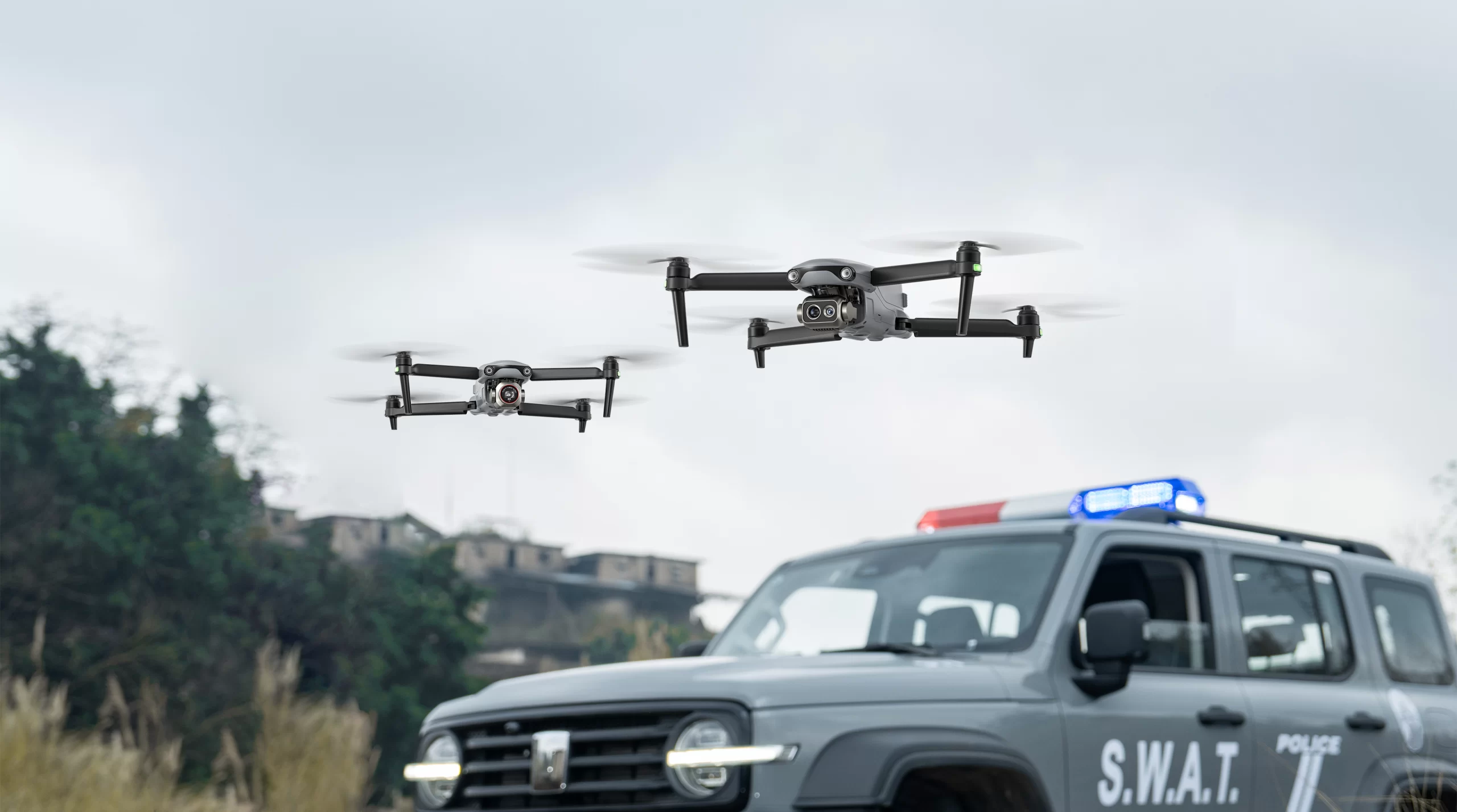
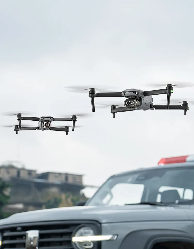
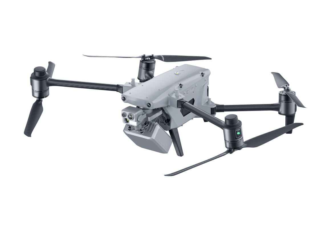
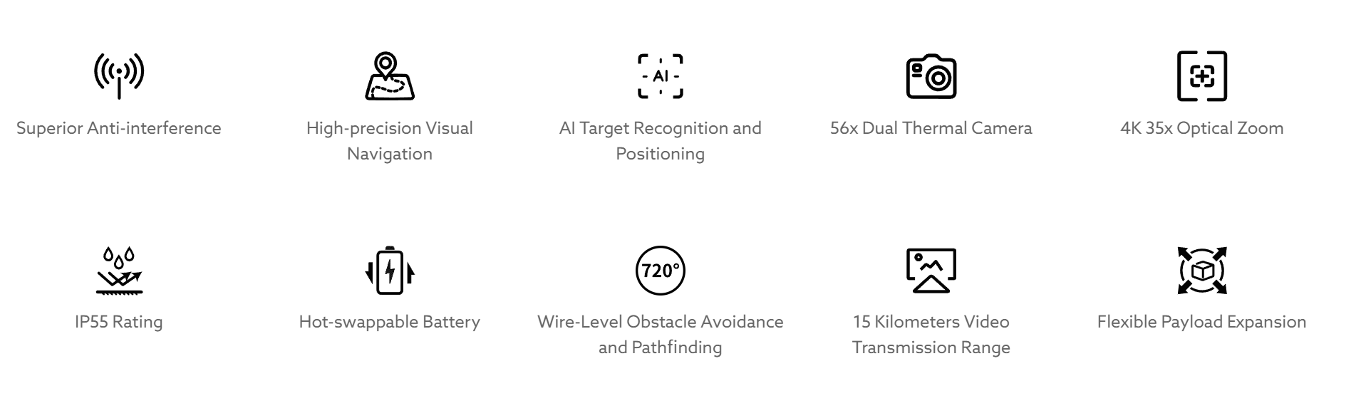
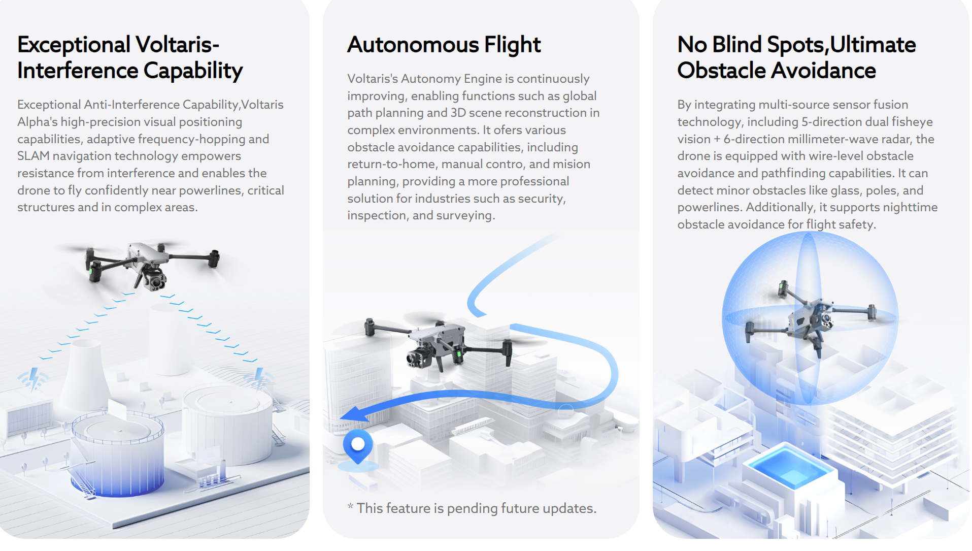
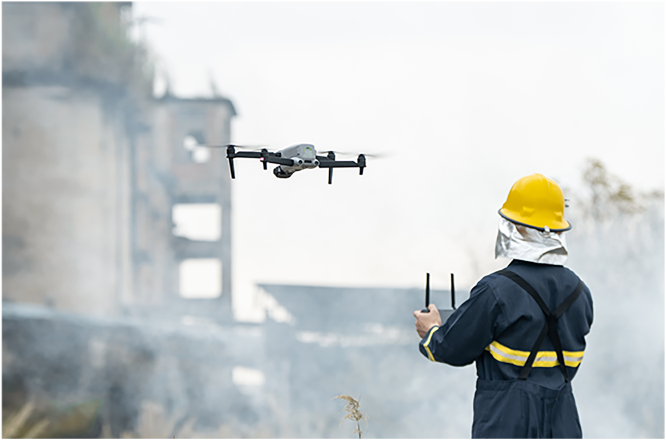
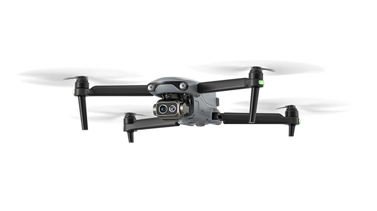
Voltaris Alpha is an intelligent industrial drone for multi-purpose. Boasting significant enhancements in autonomous flight capabilities, anti-interference capabilities, obstacle avoidance capabilities, video transmission technology, and battery systems, it injects robust performance into the flight platform. With a foldable design and IP55-rating level, it tackles challenging environments. The built-in RTK dual-antenna system ensures precise control within millimeters when carrying out the missions.Paired with the next-gen DG-L35T gimbal, it integrates a 560x hybrid zoom camera, dual thermal imaging cameras, a visible light wide angle camera, and a laser rangefinder. The dual thermal imaging cameras meet the needs of both short-range overview and long-range detail observation, achieving distant operation scenarios with unobstructed personnel recognition within an 8-kilometer range, providing more professional and comprehensive solutions for applications such as public safety, energy inspection, and emergency management.

High-definition Transmission,
900 MHz/2.4 GHz/5.2GHz/5.8 GHz 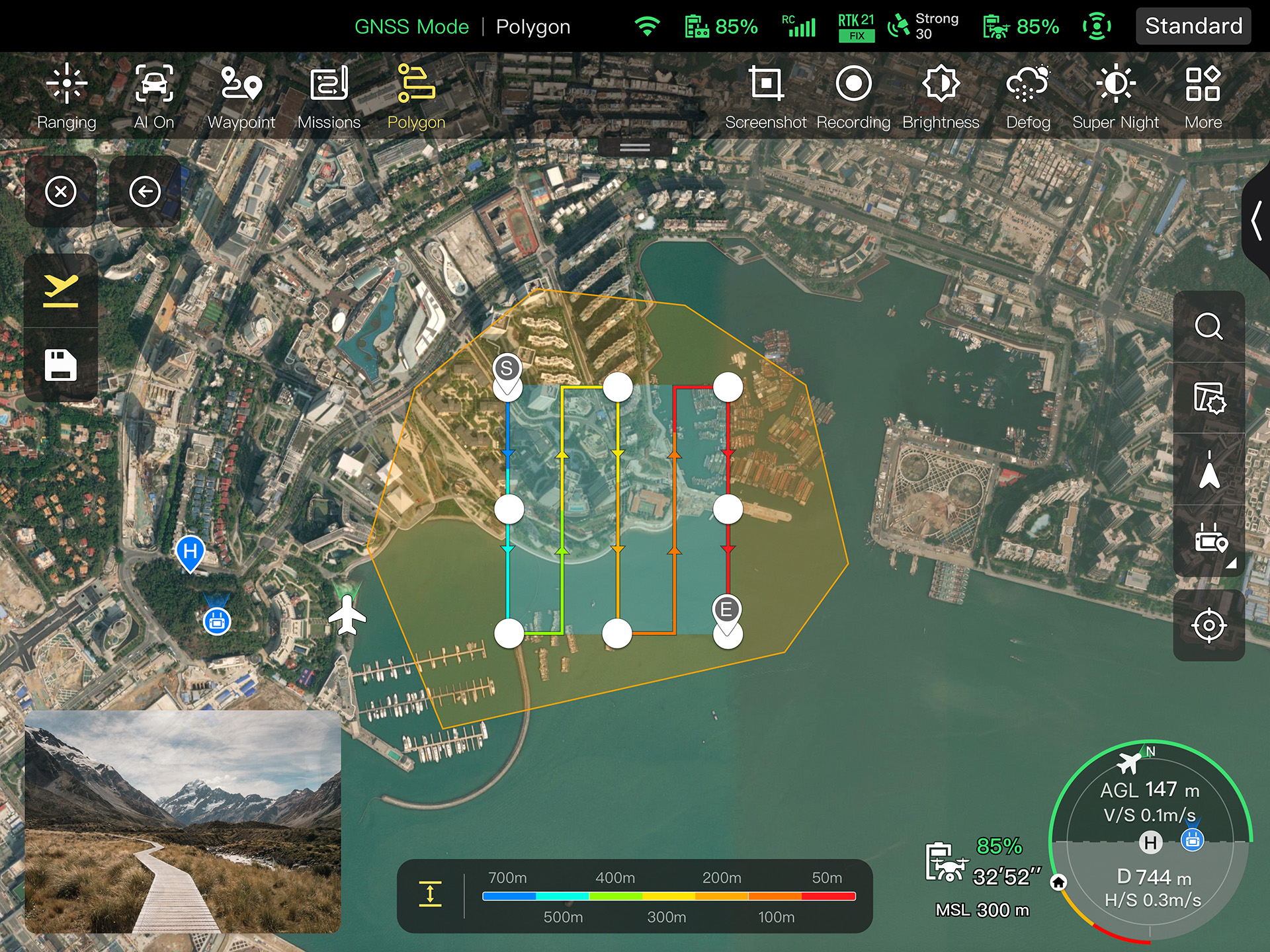

Voltaris Alpha Tracer
More+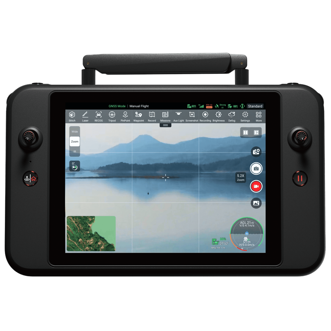
Insight Beyond Limits
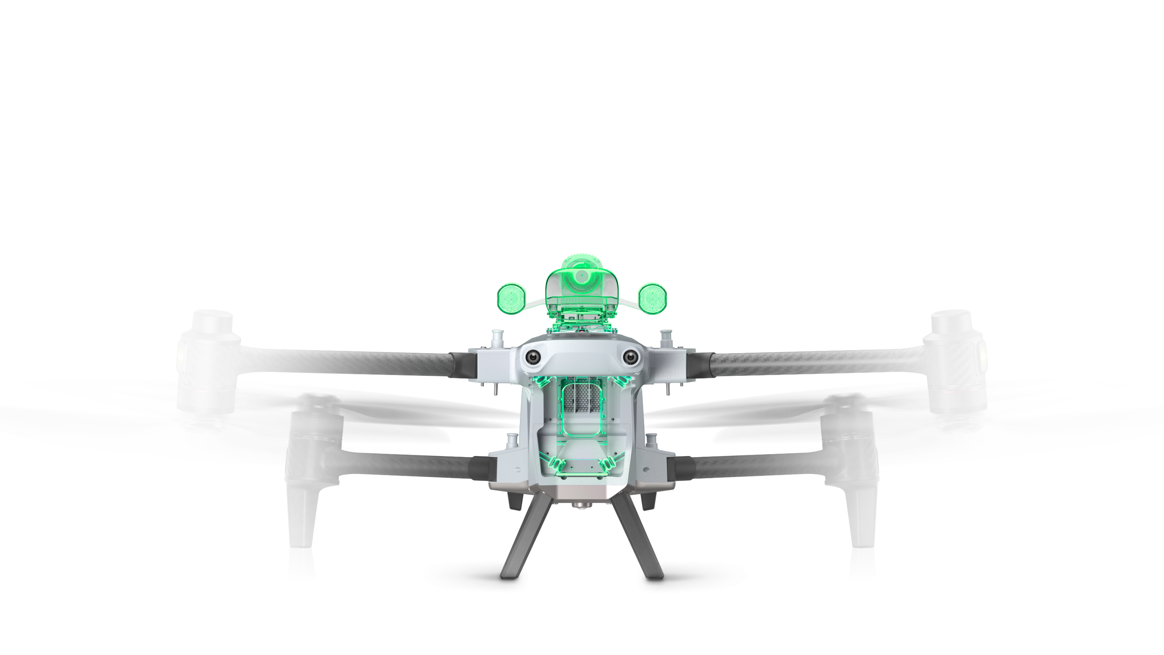
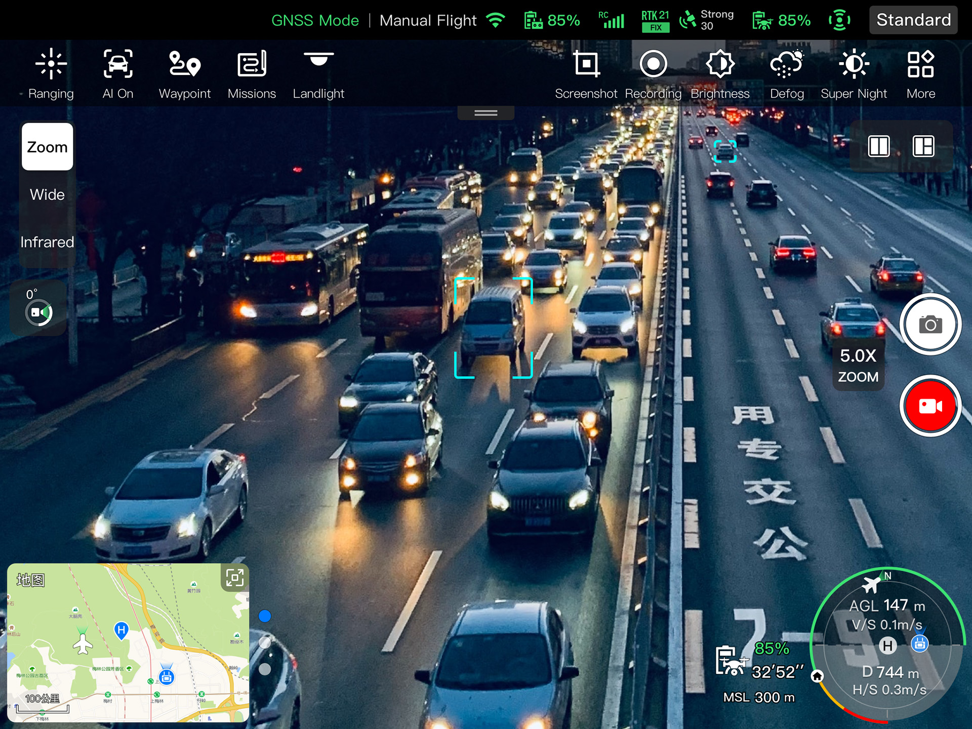
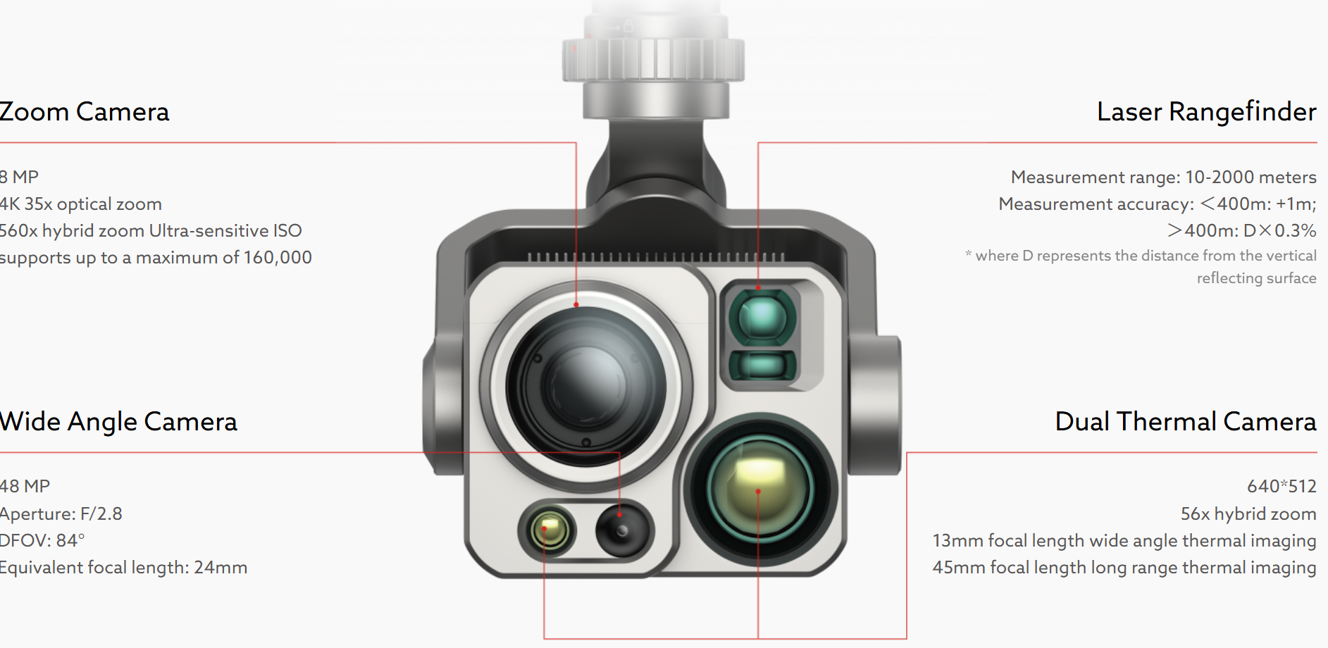
Voltaris DG-L35T Gimbal integrates dual thermal imaging cameras (short/long focal length), 4K 35x Optical Zoom Camera, a wide angle camera and a laser rangefinder.
Platform Capabilities
Redefines proficiency with its robust platform and all weather design.
Protection Rating: IP55
Wind Resistance: 12m/s
Maximum Flying Altitude: 4500 meters
Operation Temperature: -20℃ to 50℃
*With high-altitude propeller
Multiple Payload Capability
The aircraft features multiple mounting interfaces: mounting interfaces. The Voltaris PSDK developer platform is open for creating a new industry ecosystem such as searchlights, loudspeakers, and more.
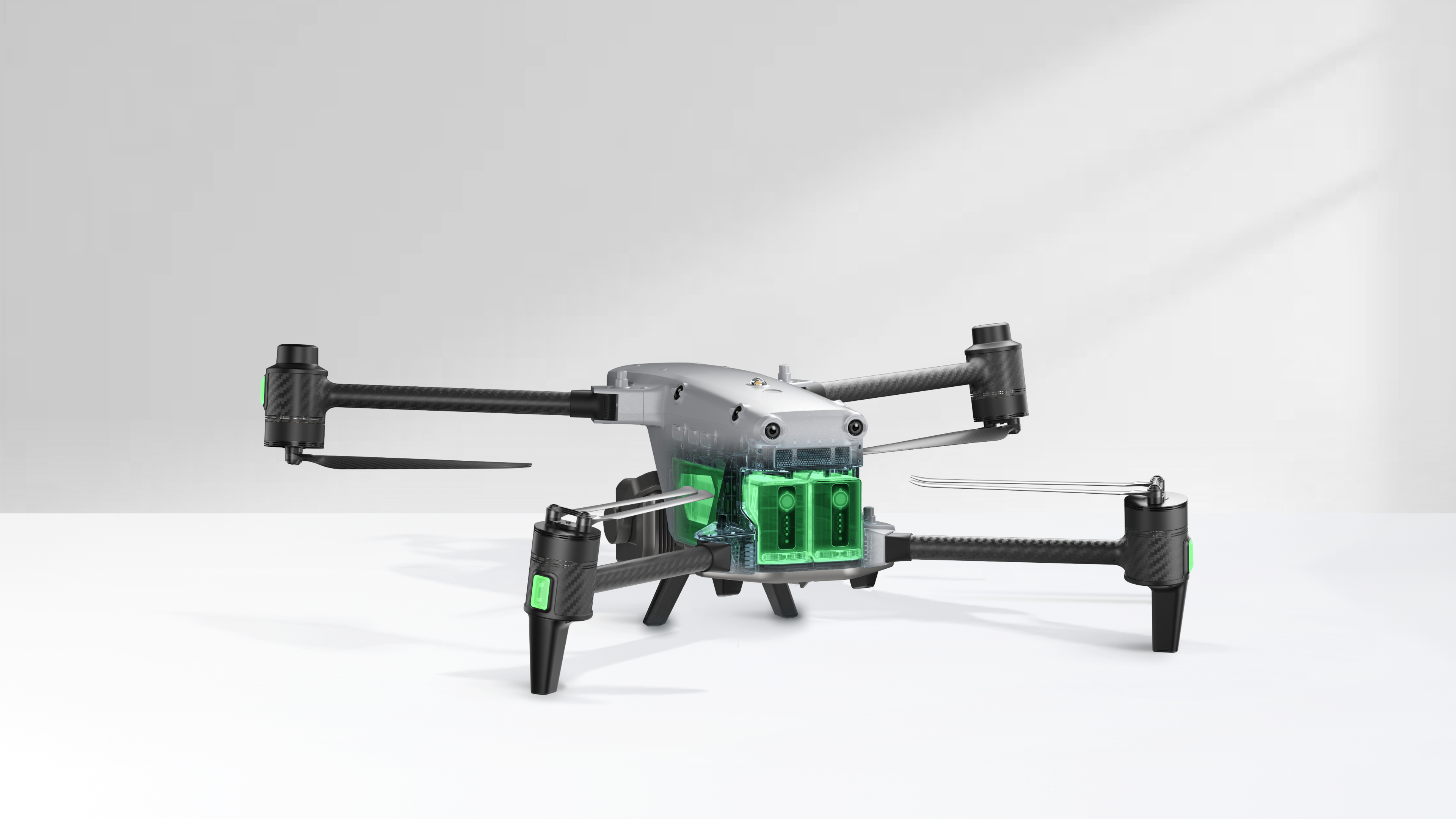
Hot-Swappable Batteries
Adopting a dual-battery redundant design, the flight time reaches 40 minutes, supporting hot-swappable batteries for seamless, efficient operations.
High-definition Transmission,
Performance Upgrade
With Voltaris Skylink 3.0, the system comes with 4 antennas, 4 Frequency bands, enabling a transmission distance of up to 15 kilometers. It supports auto frequency hopping on 900M/2.4GHz/5.2GHz/5.8GHz*, automatically selecting the optimal channel based on electromagnetic interference for robust anti-interference capabilities, featuring a high transmission of 64Mbps and low transmission latency.
Voltaris Enterprise App Platform
The Voltaris Enterprise App is built from the ground up for industrial applications and features a brand-new interface for simple, efficient operation. Additional features and semi-autonomous modes maximize the Voltaris Alpha' mission capability.
Multiple Mission Types
Smart Assistive Features
Polygon Mission
Supports one-click automatic generation of polygon flight areas
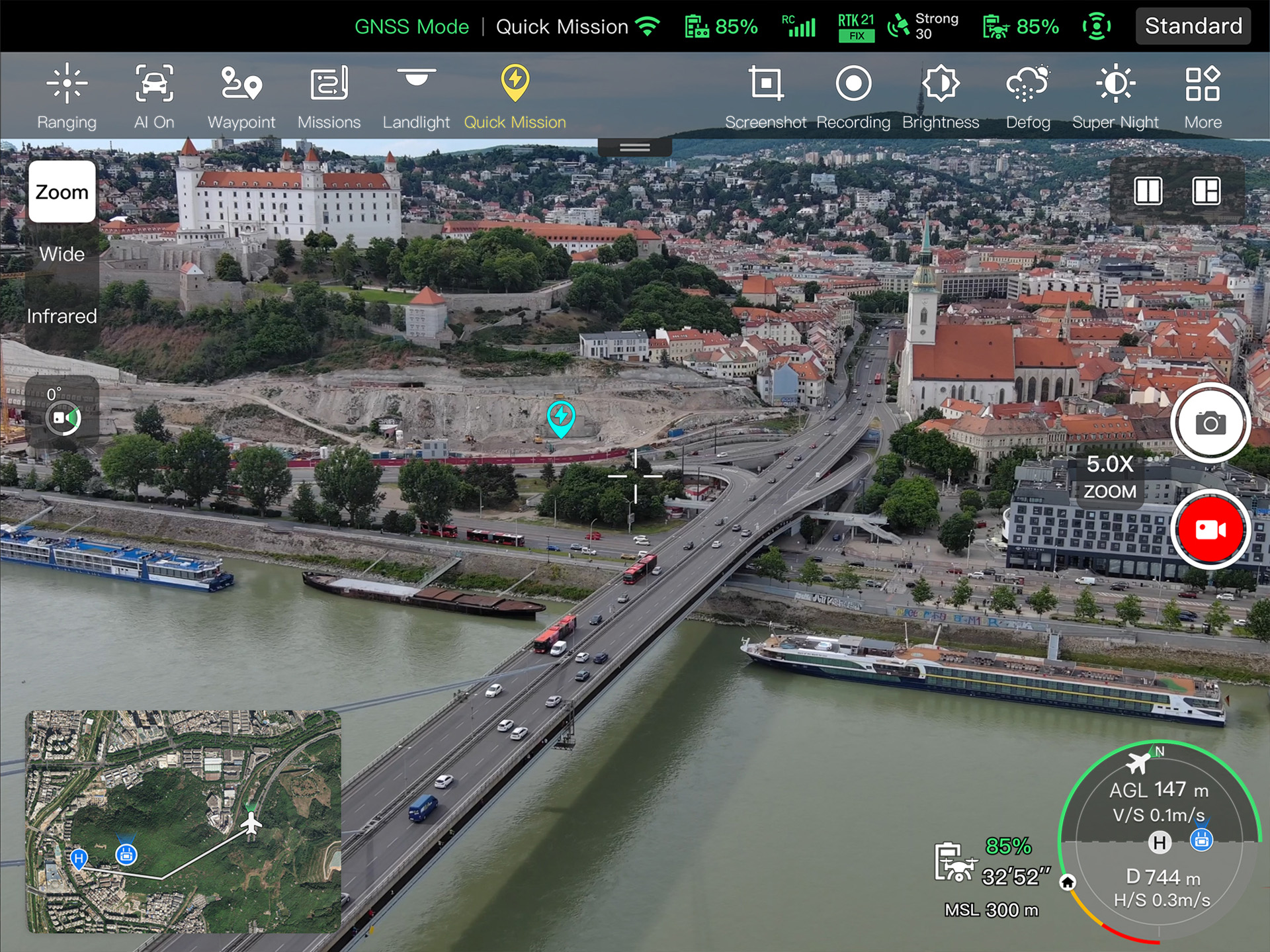
Quick Mission
Temporary quick missions can be created while executing other missions, andmultiplesub-missions can be stacked for enhanced flexibility.
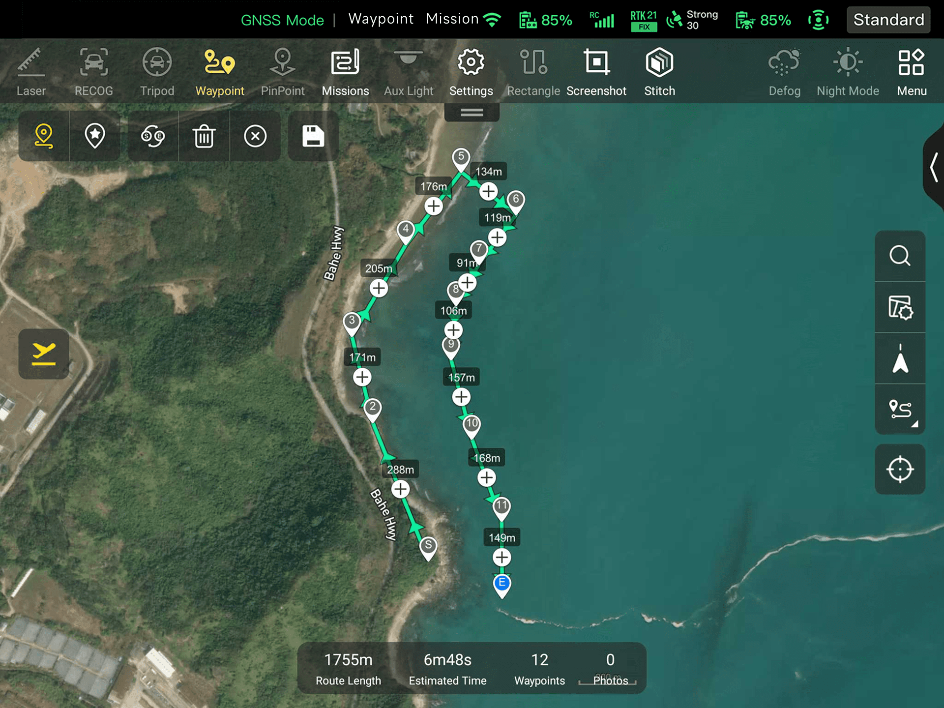
Waypoint Mission
Users can add waypoints for flexible, non-structured flight paths.
Polygon Mission
Supports one-click automatic generation of polygon flight areas
Quick Mission
Temporary quick missions can be created while executing other missions, andmultiplesub-missions can be stacked for enhanced flexibility.
Waypoint Mission
Users can add waypoints for flexible, non-structured flight paths.
Tripod
The gimbal locks onto the target, and follows the target's movement while hovering, ensuring the target remains at the center of the frame.
AI Target Recognition
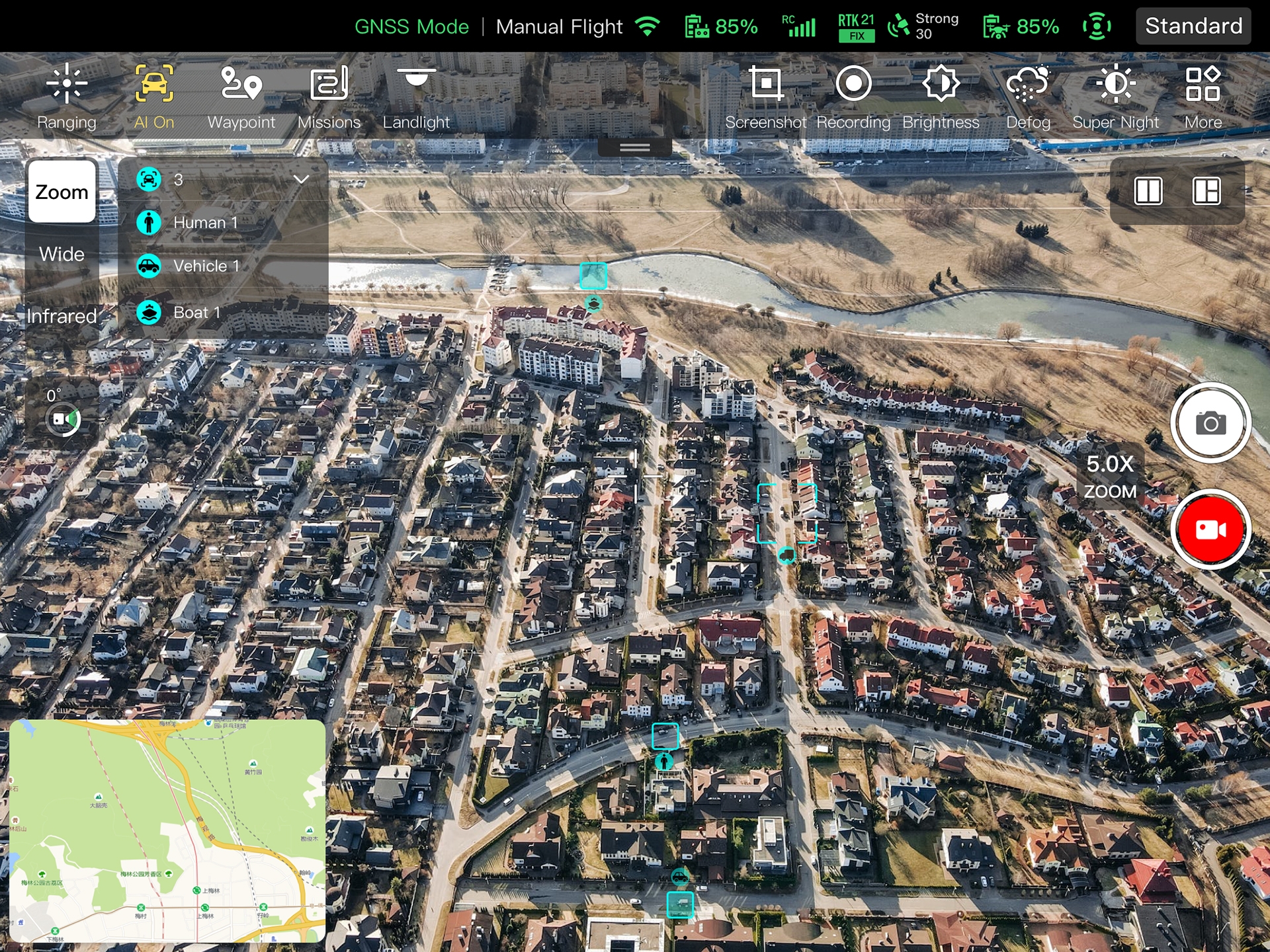
Based on Voltaris's AI recognition technology, the Voltaris Alpha can automatically identify and lock onto different types of targets such as human, boat or vehicles through zoom, wide, or infrared cameras, projecting the target's location onto the map.
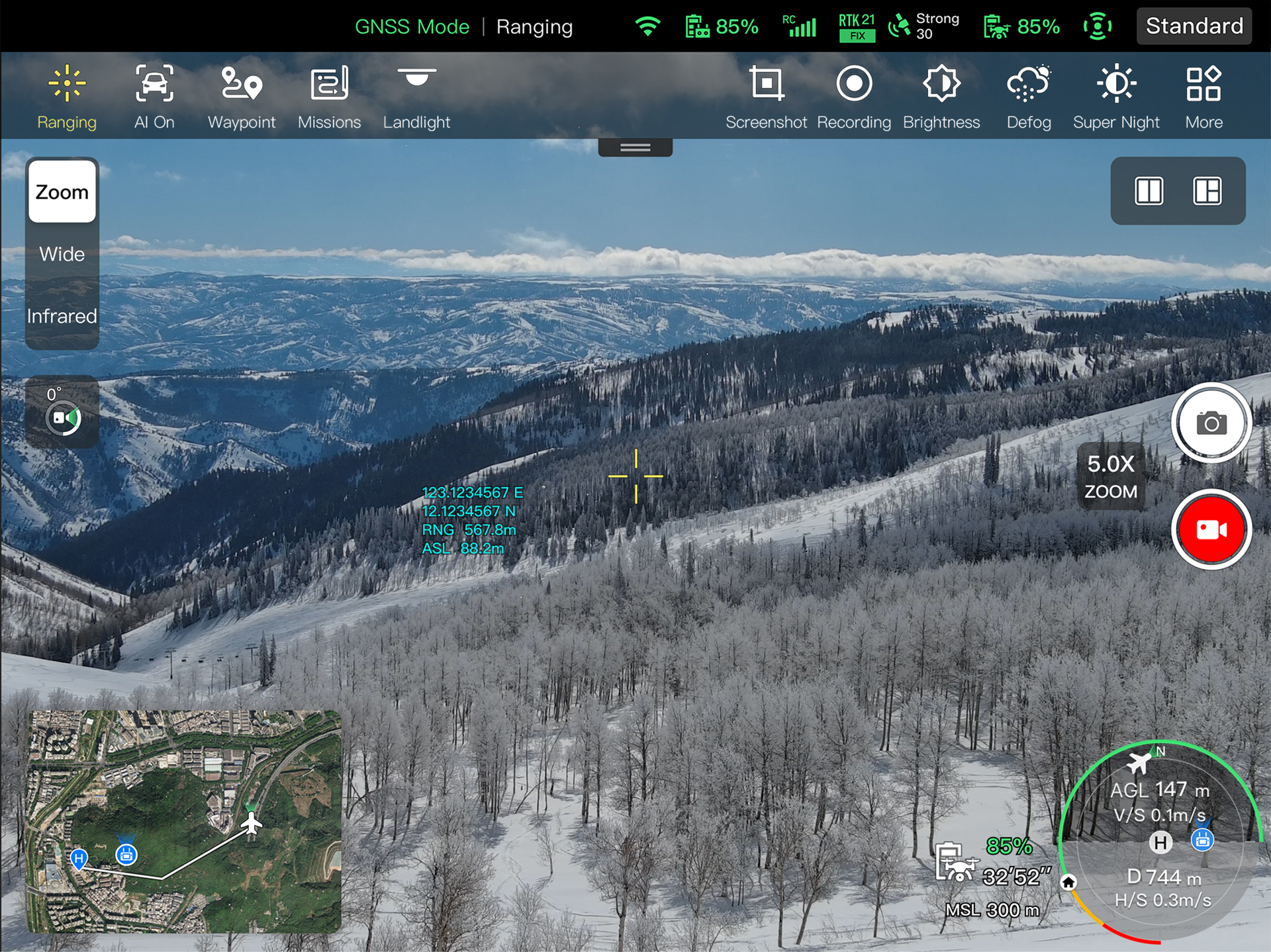
Laser Ranging
Click on the remote controller screen, it will show the target latitude, longitude, height, and other information swiftly.
Tripod
The gimbal locks onto the target, and follows the target's movement while hovering, ensuring the target remains at the center of the frame.
AI Target Recognition
Based on Voltaris's AI recognition technology, the Voltaris Alpha can automatically identify and lock onto different types of targets such as human, boat or vehicles through zoom, wide, or infrared cameras, projecting the target's location onto the map.
Laser Ranging
Click on the remote controller screen, it will show the target latitude, longitude, height, and other information swiftly.
Data Security
Privacy protection: Data involving user and aircraft information, including flight logs, locations, and account information can only be physically accessed via the aircraft locally.Encrypted Data Storage: It supports AES encryption for photos, videos, and flight logs, requiring a password input for access.
VoltarisSDK
"The Voltaris SDK is open to the world, helping developers and partners reduce software and hardware development costs and jointly create a new industry ecosystem.
Mobile SDK / Payload SDK*
A well-designed software and hardware architecture enables developers to get started with ease, offering simplicity and convenience, and empowering the creation of exceptional UAV mobile application experiences.
Voltaris Alpha Tracer
UAV Pilot Positioning Solution
The UAV pilot positioning solution aims to address the challenge of detecting UAV pilots in scenarios without broadcast protocols (Drone ID and Remote ID). By mounting high-precision radio direction-finding equipment on UAVs, it horizontally and vertically triangulates the target signal source (UAV controller) in the air, determining potential target areas and displaying them on a map.
More+Accessories
Voltaris Smart Controller V3
Daylight Readable display: 7.9 inches, 2000nit maximum brightness, 2048*1536 resolution.
SuperDownload: Download footage from drone to mobile device at a maximum rate of 20MB/s.
Functional interface: HDMI ports allow connection to 3rd party displays or monitors. The USB interface allows for 4G module expansion.
Ultra-long battery life: Up to 4.5 hours of continuous operation. 2 hours fast charging.
Local storage: Built-in 128G storage space allows 3rd party apps and mission media storage.
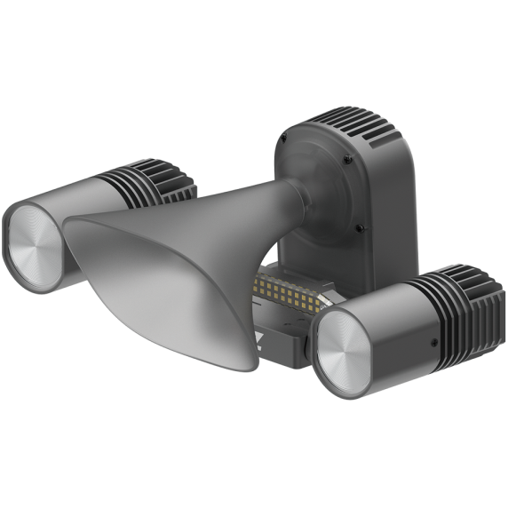
Loudspeaker And Spotlight Combo (optional)
Dimension: 196×129×78mm
Weight: 250g
Electrical Interface: PSDK Interface
Installation Method: Standard quick release mount
Working Temperature: -10 ℃ to 50 ℃
Speaker: Power @10W; Sound pressure 114db@1 meter; Broadcasting Distance≥300 m
Spotlight: Follow gimbal pitch; Brightness level adjustment; 30° to -90° controllable
Tracer Air Radio Detection Device (optional)
Size: 130×120×68 mm
Weight: 745g (holding bracket excluded); 808 g (holding bracket included)
Detection bands: 2.4G / 5.2G / 5.8G
Detection number: Up to 6 target sources at the same time
Detection range: 3km
Basic function: Pilot positioning / interference source positioning
Introduction: By mounting high-precision radio direction-finding equipment on UAVs, it horizontally and vertically triangulates the target signal source (UAV controller) in the air, determining potential target areas and displaying them on a map. Visual searching of target areas combined with AI recognition assists in discovering UAV pilots.
Contact us now to find out more
about the EVO Lite Enterprise Series
* Before conducting flight operations, users must familiarize themselves with and comply with relevant local laws and regulations. Ensure the aircraft has obtained the necessary certifications and legal airspace permissions.
* The parameters and specifications listed on this page are based on results measured under controlled testing conditions using the EVO Lite Enterprise Series. Please note that results may vary under different external environmental conditions, usage methods, and firmware versions. Therefore, actual user experience should take precedence.
* Regarding flight time, the data is obtained under conditions with no wind or other flight interferences, with the aircraft's obstacle avoidance behavior set to braking mode, and the camera performing photo capture only. The aircraft flies continuously at 8 m/s at sea level until the battery reaches 0% capacity. This data is for reference only. To ensure flight safety, users should closely monitor the App's notifications during actual flight operations.
* According to relevant laws and regulations, countries such as China and South Korea only permit the use of downward-facing 24G radar (i.e., millimeter-wave radar installed on the underside of the aircraft for downward detection). For specific usage requirements, please refer to the laws and regulations of the respective country.
* Refers to the maximum wind speed the UAV can withstand in fixed-wing mode.
* If you need more information,please contact our sales team.