UAV Pilot Positioning
UAV Pilot Positioning
Overview
The UAV pilot positioning solution aims to address the challenge of detecting UAV pilots in scenarios without broadcast protocols (Drone ID and Remote ID). By mounting high-precision radio direction-finding equipment on UAVs, it horizontally and vertically triangulates the target signal source (UAV controller) in the air, determining potential target areas and displaying them on a map. Visual searching of target areas combined with AI recognition assists in discovering UAV pilots. Additionally, the Voltaris Alpha is equipped with anti-radio interference capabilities and stable flight navigation without GNSS, ensuring the solution's stable operation in complex radio environments.
Pain Points
-

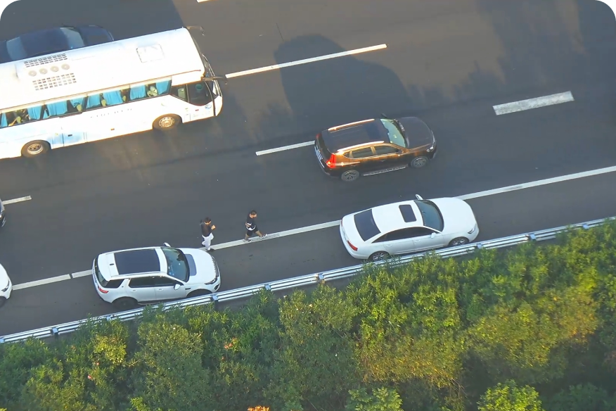
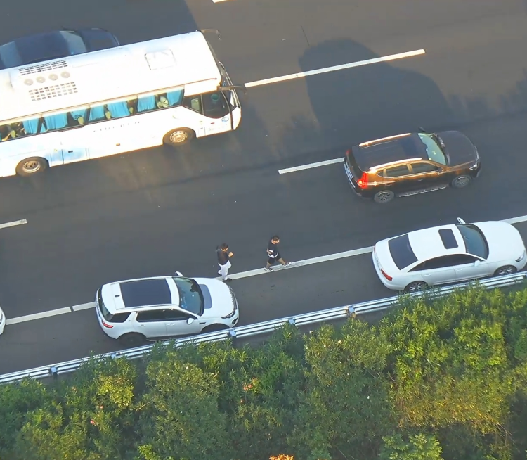
Multiple Blind Spots
Fixed cameras have limited coverage. Blind spots remain on highways and heavily regulated roads. Enforcement is weakest in most needed sections.
-

Limited Inspection Reach
Motorcycle patrols face heavy pressure. Police resources are stretched thin. Routine highway coverage is hard to maintain.
-

Low Response Efficiency
Road hazards strike suddenly. Response is rarely fast enough. The longer the delay, the greater the danger of secondary accidents.
Business Value
-


Greater Patrol Efficiency
One flight scans all roads within a 5 km radius. 24/7 operations greatly enhance patrol efficiency.
-
Faster Emergency Response
UAVs launch in 1 min, reach sites in 3. Low views help AICS make rapid, effective decisions.
-
Lower Operational Costs
UAVs replace police patrols, cutting manpower by 50%. Automated patrol, evidence, and reports cut officer and command center workload by 90%.
Recommended Voltaris Products
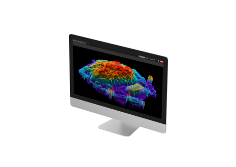
Voltaris Mapper
Swift and Accurate | 3D Reconstruction | 2D Reconstruction Aerial Triangulation | Real-time 2D | Quick Stitching
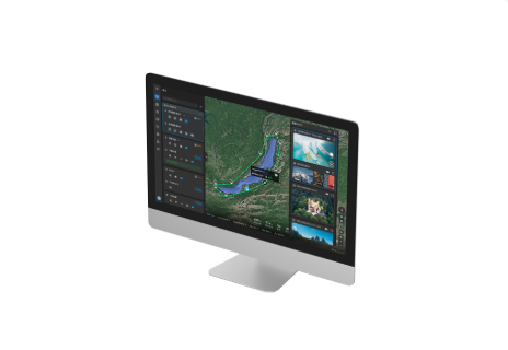
Voltaris Integrated Command System
Project And Mission Management | Data Storage And Analytic Remote Fleet Control | Multi Channel Live Streaming
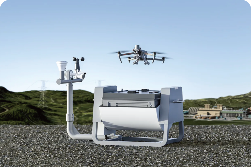
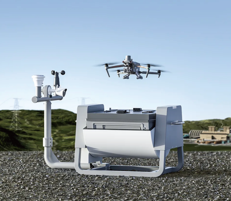
Voltaris Dragonfish Nest
Auto Takeoff, Landing, And Charging |Autonomous, Semi-Autonomous, Or Remote Piloting|-31℉ to 122℉ Operating Temperature Cloud Management|Intelligent Power Swap System|Custom Solut
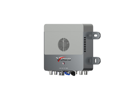
Dragonfish Repeater
Powerful Self-Organizing Mesh Network Capability | Low Maintenance | Easy Range Extending Capabilities Ultra-stable HD Image Transmission | Long-Lasting Battery | Remote 4G Monito


Autel Integrated Command System
Real-Time Situational Awareness
AI Target Recognition | Data Security
Learn More
Loudspeaker & Spotlight Combo
Quick Release Mount | 150 m Lighting Distance
300 m Broadcasting Distance